Explore the Rock River National Water Trail
Here’s a brief look at each of the sections you can canoe and kayak on the Rock River National Water Trail in Dodge County.
The Rock River Water Trail is a 320-mile National Water Trail that travels through beautiful rural and wilderness landscapes from its headwaters near the Horicon Marsh to the Mississippi River at the Quad Cities of Illinois and Iowa. Here’s a brief look at each of the sections you can canoe and kayak in Dodge County in central Wisconsin.
Northern Water Trail
Begin your paddling adventure on the Rock River Water Trail at Waupun County Park. The south branch of the river flows through Waupun and is an easy trip during normal water levels but can be shallow in places if weather conditions have been dry.
The south branch joins the west branch to form the main river stem near State Highway 49 at the northern edge of the Horicon Marsh. The river then flows south through rural and wilderness landscapes to the Horicon National Wildlife Refuge. Learn more here.
East Branch to Horicon
The East Branch of the Rock River flows west from Theresa State Marsh in Washington County to the Village of Theresa in Dodge County. The water trail begins at Rivers Edge Park in Theresa and flows through rural landscapes and the communities of Mayville and Kekoskee and into the wilderness area of the Horicon Marsh State Wildlife Area, where it joins the main river stem.The segment from Theresa Village Park to Mayville Park is 11 miles in length through rural landscape and river meanders with no public access site along the route. Rest stops and emergency landings can be made at road crossings. Stream depth between Mayville and Kekoskee is shallow at times and must be checked.The 7-mile segment through the Horicon Marsh is wetland wilderness, an internationally recognized bird sanctuary with undisturbed natural beauty. The river leaves the Horicon Marsh at the City of Horicon. Several access sites are available in Horicon with portage of the Horicon Dam at Legion Park. Learn more here.
Horicon to Hustisford to Watertown
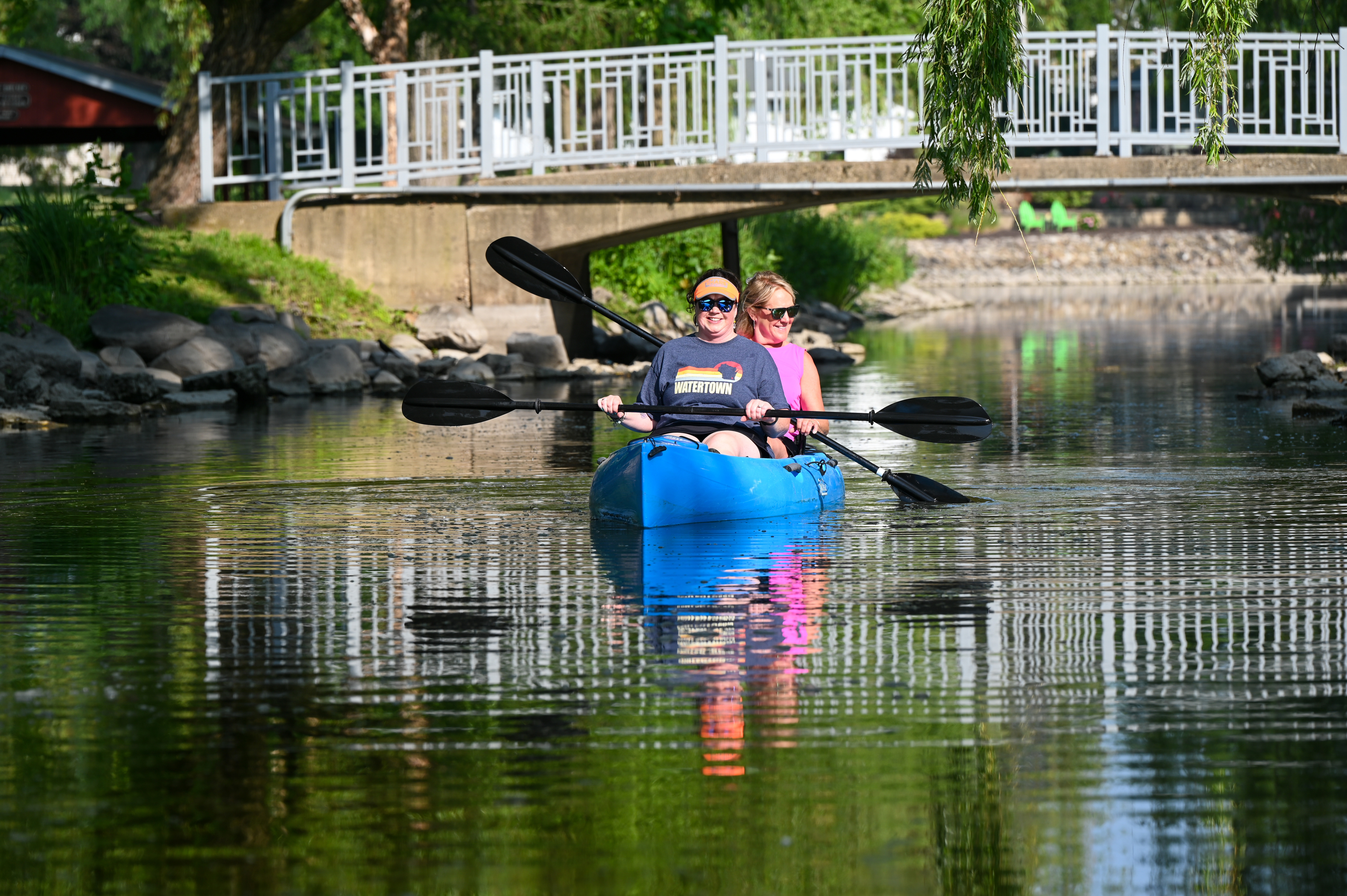
The river flows south from Horicon through rural landscapes and farmland to eventually widen and form Lake Sinissippi, a 3,000-acre impoundment of the Hustisford Dam in HustisfordFrom Hustisford, the river flows 44 miles through scenic meanders and wilderness areas to the City of Watertown. The river is less than 100 feet in width along the segment to Harnischfeger Park, and paddlers must watch for possible tree strainers and log jams in narrow spots. There are several long segments with limited-access sites, including the 17-mile segment from Hustisford to Harnischfeger Park.Two long segments from Harnischfeger Park to Kanow County Park and to County Road P in Pipersville are beautiful stretches of the river through undeveloped and rural landscapes. Learn more here.
Learn more about the Rock River Water Trail here.